|
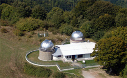
Leave your car in the Astronomy Observatory car park and take the
rough track that climbs off to the right. Go beyond the barrier
for the municipality of Montana and continue the gentle climb to
a large freestanding beech wood where there is a rest area with
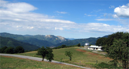
picnic facilities. A panorama opens up to the south onto the Limestre
valley which heads west to the Lima valley, northwest to the apenine
ridge of the mountains of Pistoia, with the characteristic outlines
of the "Libro Aperto" and "Monte Cimone". The
grassy plain that surrounds the beech wood is used as a "launching
platform" for the many paragliders who, especially in summer,
fly the short route (about 1.5km) to S. Marcello 380 metres lower
down.
The rough track continues with a slight gradient into the Teso
Forest and through a thick wood of fir, pine and larch trees. Raspberry
bushes (Rubus ideaeus) and wild strawberries (Fragaria vesca) grow
along the sides of the track while farther away; at the feet of
the conifers it is possible to glimpse small animals such as squirrels
or hares.
After about 1.5 kilometers (take the right at both the forks) the
road flattens out and you continue the virtually flat track for
another 2 kilometers. Along this last stretch S. Marcello municipality
has built a stone fountain, which is fed from a water supply rich
in minerals.
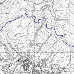
The rough track continues for several hundred meters until it reaches
the foothills of Mount Peciano. From here we advise to turn back
(there is an unmarked path which is very awkward to follow that
takes you down to Maresca).
.
|