|
|
 |
|
|
 |
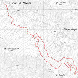
| Route
3 |
|
| 3 - Bicycle
Circuit of Faggeta |
| |
| Change in level |
250 metres |
Recommended period |
spring, summer, autumn |
| Length |
13 km |
Type of route |
tarmac road, rough track |
| Difficulty |
average |
Starting point |
Pian di Novello. The route runs along an almost completely rough track with no significant walking difficulties but having said that the route requires a high level of fitness due to the change in level. |
|
|
| Signs: white and red |
|
| |
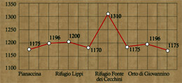  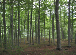  |
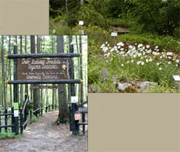
From the car park in the village of “Pianaccina”, above the campsite, you take the forest road, which runs along the edges of the ski slope called “Beatrice” and pass through a beech wood for about 200 metres until you reach a metal barrier. A small climb on a tarmac road and after about 3 kilometres you get to the Lippi Refuge (Lagacciolo) where it is possible to fill up your water bottles with the fresh spring water and rest. The fork, near the refuge, is the key point for a circular itinerary – cross-country skiing route – that can be taken in either direction.
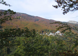
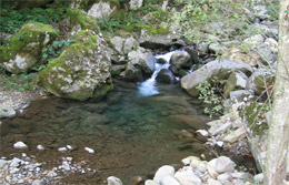
Taking the left fork, after a flat stretch and then a downward stretch you start to climb till you reach the characteristic wooden refuge“Fonte dei Cecchini” (1310m). To the left of the refuge, near the fountain, a path rises rapidly on the ridge and takes you, after several hundred metres, to the place called“Prato Bellincioni” where there is a vast open viewpoint of the local mountains – the Penna di Lucchio and the Balzo Nero – where the Scesta stream cuts its path and where Golden Eagles nest. After the refuge, there is a small climb immediately followed by a path downwards to the Lippi refuge. This itinerary winds its way, in its entirety, through a beech wood and some of the most spectacular mountains in the area, which, with its undulating terrain offers a great area for mountain biking.
.
|
| |
|
 |
| Circular Cycle
Route of the Beech Wood: |
| The route follows, almost completely, a rough track, which crosses the beech wood of Pian di Novello. It is not seen as a difficult route but due to the considerable ups and downs, being in good physical shape is a must. |
| Click on the map to open a bigger
image, if you prefer you can download the GPS file in
the
download page. |
|
| |
How to get to Pian degli Ontani by car:
- from Pistoia: reachable by road SR no. 66 until La Lima and then road SS no.12 dellAbetone e del Brennero (for Abetone and Brennero) for 4 km taking a left onto the provincial road at Casotti
- from Lucca: reachable by road SS no.12 dell'Abetone e del Brennero (for Abetone and Brennero) taking a left onto the provincial road at Casotti..
|
|
| |
|
|
 |