|
|
 |
|
|
 |
| Route
3 |
|
| 3
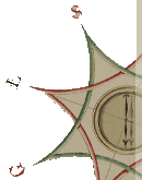
- BICYCLE CIRCUIT OF ABETONE |
| |
| Slope |
167 meters |
Recommended period |
Spring, summer and
autumn |
| Length of |
9.4 km |
Starting point |
Abetone (1385 m above
sea-level) |
| Difficulty |
Easy |
Type of path |
Dirt track, mule track,
asphalt road. |
|
|
| Signs: white and red |
|
| |
    |
The circuit is not that difficult and
is suitable for all people.
From the main square of the town, take the road to the right of the
"pyramids" which climbs lightly towards the "Uccelliera".
After 50 metres, veer right into the forest "Boscolungo".
Past the barrier, the route continues on a dirt track and reaches
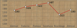
a stone fountain after about 2 km. Here, go around Mount Maiori to
the left along path no. 5.
The track rises and falls, leading to the Verginina of Serrabassa
(1487 m), which is the highest point of this route.
To return to Abetone, follow track CAI no. 80 (G.E.A. - M.P.T.). This
slopes down, at times quite steeply, to a wood of beech and fir trees.
After about 7900 metres there is a forking: the path to the right
joins up with the stone fountain, whilst the path to the left slopes
down to Boscolungo - Le Regine. Go down the mule track on the left
but be mind the drain holes which line the road. After a short while
there is a fountain near the forking towards La Secchia and the paved
mule track. Continue along to the right and then take a right at the
next forking, climbing towards the graveyard of Abetone. Follow the
signs for path CAI no.80 and at the next forking turn left. Turn right
onto road SS no.12 and go up this road for just under 1 km until you
reach the main square in the town of Abetone (1385 m).
.
|
| |
|
 |
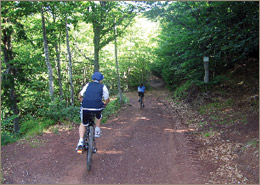
| Bicycle circuit
of Abetone |
| This
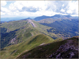
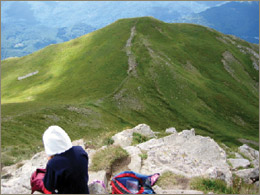
circuit is easy on mountain bikes, not very long and offers
a variety of landscapes, such as on the circuit of Mount Maiori.
There are stretches that are more demanding: towards Mount Libro
Aperto, towards La Secchia and Bicchiere, down to Rivoreta and
up from Pianosinatico to Abetone. From Boscolungo take path
CAI no. 102 which joins up with Sestaione Valley. It is highly
advisable to wear a helmet and bring a water bottle. |
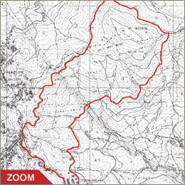
| Click on the map to open a bigger
image, if you prefer you can download the GPS file in
the
download page. |
|
| |
How to get to Abetone by
car:
- From Pistoia: Regional Road SR no. 66 and Road SS no.12
"of Abetone and Brennero".
- From Lucca and from Modena : Road SS no. 12 "of Abetone
and Brennero".
|
|
| |
|
|
 |