    |
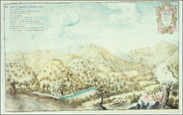
Up till a few centuries ago there was
a dense wood of fir and beech trees, which covered the mountainsides
of Abetone, so much so that the area was called "Boscolungo",
the long wood. Towards the end of the 1700s after the construction
of the road of Ximenes, a small settlement was created including an
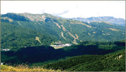
inn, a post office, border control and a few houses. Today Abetone
(whose name seems to be derived from a large fallen fir near the mountain
pass) is a famous tourist centre particularly well known for its winter
sports activities and is considered one of the most important skiing
locations in the Apennines of Tuscany and Emilia Romagna.
In the pass of Abetone the two pyramids can be easliy seen which
were built on the Tuscan - Modena border in 1777 in memory of the
road of Ximenes and the road of Giardini, works of art created by
the Grand Duke of Tuscany Leopold I and the Duke of Modena Francesco
III. On each pyramid you can see the coats of arms and the Latin
inscriptions dedicated to the sovereignties. From the pyramids we
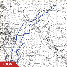
leave the road SS no. 12 of Abetone and Brennero and we take the
road to the right which climbs slightly in the direction of Uccelliera,
after about 50 meters, we head off to the right again entering the
forest of Boscolungo.
We advise you to park your car in the open area at the bottom of
the road.
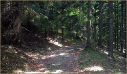
After the barrier of the Forest Rangers Corps the route follows
apparently flat ground of the rough track (loose stones) that crosses
the forest of conifers in Abetone reaching, after about two kilometers,
a stone fountain - the destination of our journey.
Along the walk, in the northeast, it is possible to see the summit
of Libro Aperto and part of the Apennines of Pistoia. To head back,
from the fountain, you take the path to the left which climbs slightly
to the left reaching the crest (path CAI no. 0-0)- The track runs
completely along the ridge parallel to the forest track visible
below in the direction of Tuscany. A short distance along the route
you can find the cylindrical stone markers which define the boundary
between the lands of the Grand Duke of Tuscany and the Dukedom of
Modena. On these you can see the date of 1792 engraved showing their
age and their progressive numbering and the direction of the border.
A short but steep stretch takes you back the dirt track.
|