    |
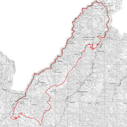
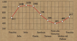
From the rail station car park (617m) take the tarmac road towards
the centre of Pracchia, after about 100 metres turn right, go through
the underpass of the railway and the alongside the buildings of
the Acqua Silva company where you climb towards the source of the
river Orticaia, first on the tarmac road and then the rough track
for about 6 kilometres rising with an average gradient of 7%. Having
reached the basin (1038m) between Poggio dei Lagoni and Poggio del
Papa you follow an almost flat section and, after having gone round
the mountainside of Poggio del Papa, you come across a junction
where going straight takes you to Collina Pistoiese (932m) in under
two kilometres; going left instead and following a well maintained
undulating rough track you cross, a dense beech wood. Less than
five kilometers along this track you tie up with the tarmac road
that rises from Pracchia to Mount Pidocchina. Descending a little
you find a track on the right (1070m) and continue to follow the
route along the mountainside. This track travels completely along
the watershed ridge between the Reno and Limentra valleys. Along
this stretch you have a great view of the valleys and the high spurs
of the Apennines. Having traveled about 3.5 kilometers and back
on the tarmac road, you start to head down till you reach a fork
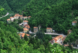
in the road. On the left, after a few minutes, you reach Posola
(942m), whereas going straight you continue the descent to another
fork which is passed by to bring us onto the mule track which leads
to Ca' di Giamba and to the Castello di Sambuca (736m). In front
of the convent you take the old mule track quickly downwards to
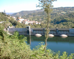
Taviano (504m), a small village on the river Limentra. To head back
to Pracchia you can take the state road no. 64 to Ponte alla Venturina
and then the road S.S. no. 632 "Traversa di Pracchia"
for about 15 kilometers.
|