|
|
 |
|
|
 |
| Route
2 |
|
| 2- Towards
Pavana - The Via Francigena |
| |
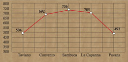
| Slope |
560 meters |
Equipment |
Water bottle, camera,
trekking shoes |
| Length of |
10 Km |
Duration of route
|
5 Hour |
| Difficulty |
Medium |
Type of path |
Rough forest track |
| Recommended period |
Summer |
Starting point |
Abetone (1385 above
sea level) |
|
|
| Signs: white red CAI no. 00 |
|
| |
 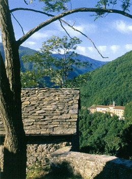 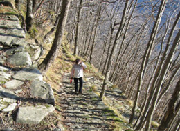 |
The first route takes you as far as Sambuca.
From the "borgo" a lovely paved road links Sambuca with
Casa Bettini and ends up in Pavana in about an hour and a half. The
mule track runs a little below the walls of the castle, with a few
ups and downs, crosses the dense forest of chestnut, maple, alder
and elm trees till you reach the fork for Casa Bettini (748m), thereafter
following the red-white signs of the CAI footpath to Pavana. Along
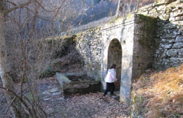
the route you can see the remains of an antique rural structure called
the "Mulinaccio" (mill) and the "borgo" (village)
of Casa Sedoni, where you can fill up your water bottles from the
characteristic washing well.
The area is of much biological interest with herds of hoofed animals
such as deer, fallow deer, roe deer, wild boar and mammals such as
foxes, weasels, martens, badgers, hedgehogs, squirrels and dormice.
The final stretch of the itinerary is a pleasant path through the
chestnut trees, which takes us from Casa Bertini to Pavana. Between
Pavana and Ponte 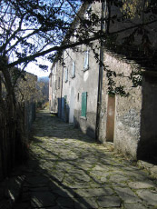 alla
Venturina, in Valdibura, you find the building of the old Grand Dukes
customs house (1846), built for the new road Leopolda Porretana near
the border between the Tuscan Grand Duke's land and that of the Papal
State. alla
Venturina, in Valdibura, you find the building of the old Grand Dukes
customs house (1846), built for the new road Leopolda Porretana near
the border between the Tuscan Grand Duke's land and that of the Papal
State.
|
| |
|
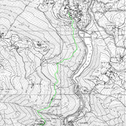 |
| Towards Pavana
- The Via Francigena |
| From
the Fortress you drop down to the centre of the village and
take the footpath, which follows the old road of via Francigena
to Pavana. The route has a slight gradient and crosses lush
woods of chestnut, maple and alder trees and a surreal tranquility
taking you to your destination of Pavana. |
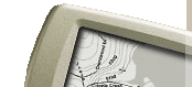
| Click on the map to open a bigger
image, if you prefer you can download the GPS file in
the
download page. |
|
| |
How to reach Sambuca by
car:
- From Pistoia: Road SS no. 64 toTaviano.
- From Lucca: Road SS no.12 "dell'Abetone e del Brennero"
(for Abetone and Brennero) turning right at La Lima onto
the road S.R.no. 66. Keep going for 15 kilometers turning
left at Pontepetri onto the road SS no. 632 "Traversa
di Pracchia" till Ponte alla Venturina and then right
onto the road SS no. 64 to Taviano.
|
|
| |
|
|
 |