|
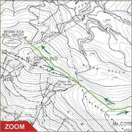
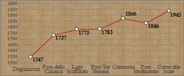
Once you've reached Lake Scaffaiolo, you
carry on east, cutting across the northern mountainside of Cupolino
and reaching the 'Tre Termini' pass (summit of the border lines between
the Papal State, the Grand Dukedom of Tuscany and the Dukedom of Modena)
in ancient times called the Calanca pass. From here, according to
some historians, Hannibal the Carthaginian apparently passed by with
his army in the spring of 217 b.C.. The leader, blind in one eye,
crossed the pass carried by the only surviving elephant after the
battles in the north of Italy.
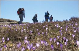
Continue along footpath CAI n. 00 that climbs gently, cutting across
the northern mountainside of Cornaccio. After a few ups and downs
you descend to the mountain pass of Strofinatoio. Footpath CAI n.
00 goes down to the right towards the pass of Cancellino, to then
climb up again on Mount Gennaio, while our itinerary carries on
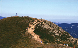
straight along footpath CAI n. 129. You then have a steep climb
for a short distance and in less than 15 minutes you reach the peak
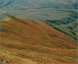
of 'Corno alle Scale' (1945 m). You'll get a striking view to the
West over the Dardagna valley and on the Apenninie ridge up to 'Libro
Aperto', and to the right the unmistakable outline of Mount Cimone.
In particularly favourable weather conditions it is possible to
see to the South Thyrrenean Sea (and various islands: Corsica, Capraia
and Elba), while to the North the Alpine range.
|