 |
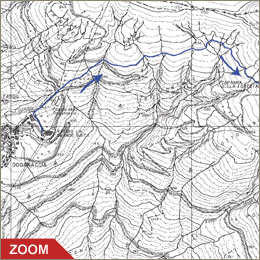
The itinerary starts by the arrival station
of the Doganacia cableway; the placename goes back to the ancient
customs of the border between the Grand Duchy of Tuscany and the Duchy
of Modena, of which today no sign remains. From here is possible,
going through the path MPT, to pass by the "Faggio di Maria"
to reach the Croce Arcana pass (m. 1675) from where is possible to
descend on the modenese mountainside towards Fanano. But our itinerary
starts nearby the little church, from where the path marked white-red
CAI n. 66 starts.
After a few dozen meters you come up to a dirt road nearby a ditch,
you go across it and carry on the footpath that cuts across the
Spigolino southern mountainside. After reaching the spring (we suggest
you to fill up water-bottles) you carry on climbing and shortly
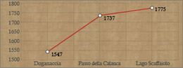
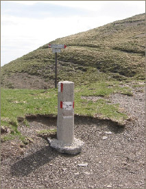
you reach the CAI n. 00 footpath (path that runs along the toscan-emilian
watershed) nearby the Calanca Pass (m. 1737). Before 1789 this pass
was called "Calanchetta" to differentiate it from the
real Calanca pass which was between Mount Cupolino and the Cornaccio
and is today called Tre Termini.
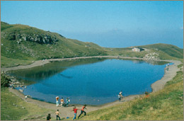
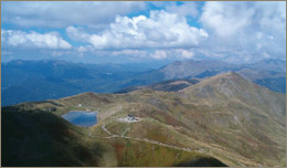
Continuing towards east you reach, in a few dozen minutes, Lake
Scaffaiolo (m. 1775) one of the most striking little lakes of the
northern Apennines. The origines of the lake, since remote times,
has been object of discussions
Continuing east you for about 12 minutes, Lake Scaffaiolo (1775
m), one of the most striking little lakes of the northern Apennines.
The origins of the lake, since remote times, have been object of
heated discussions based on different hypothesis, some of which
really odd: from the volcanic one (there's no sign of volcanic rocks
in the area), to thinking there were underground canals that fed
the lake directly from the sea. Scaffaiolo seems to derive from
"Scaffa" that is "basin" so maybe this is the
key to its origin. The waterproof rocks, that are typical of this
part of the Apennine, retain the water collected by the small water
basin, not bigger than a few hundred square meters, formed by Mount
Cupolino. The absence of vegetation, due to the high altitude, prevents
its burial. Nearby the lake ther is a shelter, recently built.
Info: Refuge 'Duca degli Abruzzi', tel. 0534 53390
|