|
|
 |
|
|
 |
| Route
2 |
|
| 2
- To the mountain pass of Termine |
| |
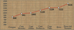
| Slope |
298 m
|
Equipment |
Water bottle, camera
and trekking boots |
| Length of return trip |
7km |
Duration of route
|
2 hrs |
| Difficulty |
Medium |
Type of path |
Dirt tracks, asphalt
roads and footpaths |
| Recommended period |
Spring, summer, autumn |
Starting point |
Case Paoluccio (1120
metres above sea-level) |
|
|
|
| |
 |
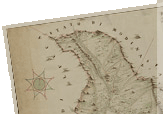
To reach the starting point, follow the
directions on Route 1 or drive from Orsigna for 4 km until you reach
Case Paoluccio.
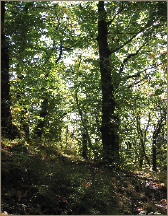
From Case Paoluccio proceed eastwards on the dirt track, going through
a beech wood sloping slightly. After a sharp bend to the left, the
track slopes more steeply until the fir tree forest. Leaving the small
shelter called Casetta Tulio to your left, the track evens out again
and then slopes down slightly until a forking which will also be on
the return trip. Take the track on the right, which climbs up to the
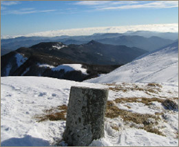
Mountain Pass of Termine (1449 m). On the ridge it is possible to
see the grand-ducal boundary stone which showed the old border between
the lands of the Papal State and of the Grand Duke of Tuscany.
The mountain pass intersects path CAI no. 143, which climbs from a
village called "Setteponti" (seven bridges) and continues
halfway up Mount Orsigna.
Having returned back down to the forking, take the dirt track and
after a small slop down take the old mule track on the left. This
descends quite steeply to the road for Case Paoluccio. If you instead
take the right, it is possible to see the old ruins of the mountain
border control stations, called "Gabellette".
|
| |
|
 |
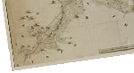
| To the mountain
pass of Termine |
From
Case Paoluccio continue east along the dirt track, which climbs
slightly. In less than 30 minutes this takes you to a forking
that climbs more steeply to the mountain pass. The ridge was
the boundary between the lands of the Papal State and of the
Grand Duke of Tuscany.
It is advisable to bring your own water.
|
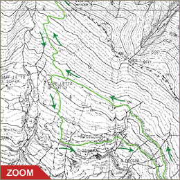
| Click on the map to open a bigger
image, if you prefer you can download the GPS file in
the
download page. |
|
| |
To reach Orsigna by car:
- From Pistoia: take road SS no. 66 until Pontepetri
then take road SS no. 632 "traversa di Pracchia"
for 4 km and go left after the town of Pracchia.
- From Lucca: take road SS no. 12 "dell'Abetone
e del Brennero" go right near La Lima on road SS no.
66 until Pontepetri and then take road SS no. 632 "traversa
di Pracchia" for 4 km and go left after the town of
Pracchia.
|
|
| |
|
|
 |