|
|
 |
|
|
 |
| Route
1 |
|
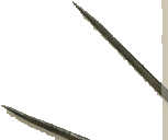
| 1
- From Orsigna to the source of Gabelletta |
| |
| Slope |
320 m |
Equipment |
Water bottle, camera,
trekking boots |
| Length of return trip |
15 km |
Duration of route
|
2 hrs |
| Difficulty |
Medium |
Type of path |
Foot-path and mule
track |
| Recommended period |
Spring, summer, autumn |
Starting point |
Orsigna (806 m above
sea-level) |
|
|
|
| |
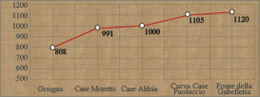  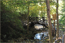 |
Cars can be parked just before the little
square in Orsigna in the small parking lot, and walk up the road to
the church. Then go down to the mill of Berto. Make sure you fill
up your water bottle at the source of the mill under the bridge and
continue on the asphalt road for a brief climb at 815 m altitude,
where you take the old mule track on the right (path CAI no. 5) which
goes past an old shrine.
The mule track climbs steeply around a series of bends in the thick
chestnut forest. Along the way, despite the poor conditions of the
path, it is still possible to find paved bits, stone drains for the
rainwater and little dry-stone walls, which lined the road. You will
reach Case Moretto after a 20-minute walk (991 m).
Near the fountain in the square, the mule track forks off to the left
and continues towards Case Aldria (1000 m). Go past the few houses
and keep going up the mule track, which climbs up through the thick
gnarled roots of the beech trees. After a few minutes you will cross
the dirt track, which goes up to Case Paoluccio. Take the track that
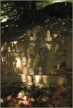
curves to the right and evens out until you reach a small glade called
"Pian dell'Osteria", where there is a stone building. Continue
in the same direction and go past a ditch, climbing up among stonewalls
and clay stone slabs in the ground, until you reach the source of
Gabelletta.
|
| |
|
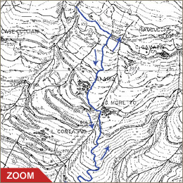 |
| From Orsigna
to the source of Gabelletta |
| This 15-kilometer
route is of medium difficulty on footpaths and mule-tracks.
From the town of Orsigna go along the asphalt road for a short
stretch and then take the old mule track, which climbs rather
steeply to Case Moretto and on to Case Aldria. This curves to
the left near the dirt track to Paoluccio and then evens out
until the source of Gabeletta. Chestnut and beech trees and
coniferous woods shade the whole way. |
| Click on the map to open a bigger
image, if you prefer you can download the GPS file in
the
download page. |
|
| |
To reach Orsigna by car:
- From Pistoia: take road SS no. 66 until Pontepetri
then take road SS no. 632 "traversa di Pracchia"
for 4 km and go left after the town of Pracchia.
- From Lucca: take road SS no. 12 "dell'Abetone
e del Brennero" go right near La Lima on road SS no.
66 until Pontepetri and then take road SS no. 632 "traversa
di Pracchia" for 4 km and go left after the town of
Pracchia.
|
|
| |
|
|
 |